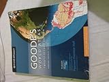
Folded Map: Miami, Fort Lauderdale, and West Palm Beach Regional Map (Rand McNally Miami/Fort Lauderdale/West Palm Beach)
Book Details
Author(s)Rand McNally
PublisherRand McNally
ISBN / ASIN0528007866
ISBN-139780528007866
AvailabilityIn Stock.
Sales Rank863,638
MarketplaceUnited States 🇺🇸
Description
Rand McNally's folded map for Miami, Fort Lauderdale, and West Palm Beach is a must-have for anyone traveling in and around this part of Florida, offering unbeatable accuracy and reliability at a great price. Our trusted cartography shows all Interstate, U.S., state, and county highways, along with clearly indicated parks, points of interest, airports, county boundaries, and streets. The easy-to-use legend and detailed index make for quick and easy location of destinations. You'll see why Rand McNally folded maps have been the trusted standard for years
Regularly updated
Full-color maps
Clearly labeled Interstate, U.S., state, and county highways
Indications of parks, points of interest, airports, county boundaries, downtown & vicinity maps
Attractions & Golf courses
Enlargments of Boca Raton, Coral Gables, Fort Lauderdale, Key West, Miami, Miami downtown, Miami Beach downtown, Miami International Airport & Palm Beach
Easy-to-use legend
Detailed & full street index
Convenient folded size
© 2013
Communities Included: Delray Beach, Doral, Florida Keys, Hollywood, Homstead, Jupite Island, Miami Beach, Palmetto Bay, Plantation, Pompano Beach, Wellington, Weston
More Books by Rand McNally