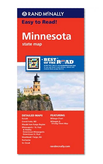
Rand McNally Easy To Read: Minnesota State Map
Book Details
Author(s)
Rand McNally
Publisher
Rand McNally
ISBN / ASIN
0528881779
ISBN-13
9780528881770
Availability
Usually ships in 24 hours
Sales Rank
#293,797
Marketplace
United States 🇺🇸
Description
Rand McNally's Easy To Read State Folded Map is a must-have for anyone traveling in and around Minnesota, offering unbeatable accuracy and reliability at a great price. Our trusted cartography shows all Interstate, U.S., state, and county highways, along with clearly indicated parks, points of interest, airports, county boundaries, and streets.
The easy-to-use legend and detailed index make for quick and easy location of destinations. You'll see why Rand McNally folded maps have been the trusted standard for years.
40% larger map with a bigger type size than the Rand McNally Folded Map
Clearly labeled Interstate, U.S., state, and county highways
Indications of parks, points of interest, airports, county boundaries, and more
Mileage and driving times map
Detailed index
Convenient folded size
Detailed maps of: Duluth, Grand Forks, ND; Mesabi Iron Range Region, Minneapolis/St. Paul & Vicinity, Downtown Minneapolis, Downtown St. Paul, Moorhead/Fargo, ND; Rochester, St. Cloud