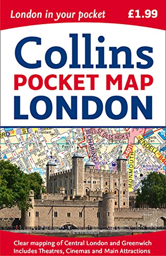
Collins Pocket Map London
📄 Viewing lite version
Full site ›
Book Details
Author(s)Collins UK
PublisherCollins
ISBN / ASIN0008214174
ISBN-139780008214173
AvailabilityOnly 1 left in stock - order soon.
Sales Rank7,047
CategoryMap
MarketplaceUnited States 🇺🇸
Description ▲
This handy little full color map of central London is filled with a high level of detail and clear mapping from Regent’s Park in the north to Kennington in the south, and Kensington Gardens in the west to Tower Bridge in the east at a scale of 1:12,500 (5 inches to 1 mile). Maps of West End shopping and theaters are also included. Clear, detailed, full color mapping is presented in a handy format, ideal for the pocket or handbag. It is excellent value and covers the most visited area of central London. It is an essential buy for tourists and residents alike, and includes a detailed central area map, a theaters and cinemas map, a shopping map, an Underground map, and the latest congestion zone boundary.
Similar Products ▼
- Streetwise London Underground Map - Laminated Map of the London Underground, England (Michelin Streetwise Maps)
- Edinburgh Pocket Map
- StreetSmart London Map by VanDam - City Street Map of London, England - Laminated folding pocket size city travel and Tube map with all museums, attractions, hotels and sights; 2018 Edition
- Collins Pocket Map Dublin
- London (National Geographic Destination City Map)
- London PopOut Map (PopOut Maps)
- London Bus & Underground PopOut Map (PopOut Maps)
- Rick Steves Pocket London
- Streetwise London Map - Laminated City Center Street Map of London, England (Michelin Streetwise Maps)
- Michelin Paris Pocket Map 50 (Plan Poche)
More Books in Map
Italy South 1:500,000 Travel Map (Travel Reference Map…
View
Veneto/Friuli-Venezia Giulia (Regional Road Map)
View
France, Reversible (Maps/Country (Michelin))
View
Central America Nelles Map (English, French, Italian a…
View
Corfu 1:50 000 (English, Spanish, French, Italian and …
View
Southeast Lighthouses Map - Laminated Poster
View
South America Classic [Enlarged and Laminated] (Nation…
View
Maine, New Hampshire & Vermont State Laminated Map
View
Afghanistan 1:1,000,000 Travel Map (International Trav…
View