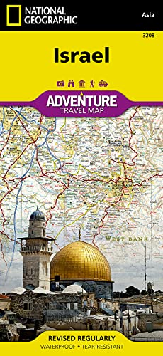
National Geographic's Israel Adventure Map is the perfect travel companion for Holy Land adventure travelers. This expertly researched map details the country with unparalleled information not found in traditional road maps. Hundreds of diverse and unique recreational, ecological, cultural, and historic destinations are pinpointed, including many hidden gems, such as Islamic and Jewish sacred sites, churches, mosques, archeological site, beaches, hotels, hostels, airports and harbors. A clearly marked network of both primary and secondary roads, shown with distances, along with an index of cities and towns will guide you on your adventure, while mapped hiking trails, including The Israel Trail, will help you get off the beaten path.
This comprehensive map covers Israel in its entirety and complements any guidebook to the region. Also shown are Palestinian areas in the West Bank and Gaza Strip and bordering areas in Jordan, Syria and Lebanon. The country's three most populated cities Jerusalem, Tel-Aviv and Haifa can be found on the map's northern side, along with the Sea of Galilee (Kinneret), Nazareth, the Golan Heights and most of the Dead Sea. The map's southern side covers the cities of Be'ersheva, Hebron, Bethlehem and Eilat along with the Gaza Strip, Dead Sea, the ancient fortification of Masada and the Jordanian city of Aqaba.
Every Adventure Map is printed on durable synthetic paper, making them waterproof, tear-resistant and tough — capable of withstanding the rigors of international travel.
- Map Scale = 1:275,000
- Sheet Size = 25.5" x 37.75"
- Folded Size = 4.25" x 9.25"