Easy To Read: North Carolina (Rand McNally State Maps)
Book Details
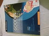
Author(s)Rand McNally
PublisherRand McNally
ISBN / ASIN0528881825
ISBN-139780528881824
AvailabilityUsually ships in 1 to 3 months
Sales Rank94,590
MarketplaceUnited States 🇺🇸
Description
Rand McNally's folded map for North Carolina is a must-have for anyone traveling in or through the state, offering unbeatable accuracy and reliability at a great price. Our trusted cartography shows all Interstate, U.S., state, and county highways and much more.
Points of interest
State park chart
State mileage chart
Driving times map
On-the-road toolbox
Visitor center information
Climate data
State facts & symbols
Easy-to-use legend
Detailed indexed
Coverage Area
Detailed maps include: Asheville, Charlotte, Fayetteville, Gastonia, Great Smoky Mountains National Park, Raleigh/Durham/Chapel Hill, Wilmington, Winston-Salem/Greensboro/High Point
Product Details
Measures 9.0" x 4.125" and folds out to 25.5" x 36.75"
Similar Products
More Books by Rand McNally