


Paul Smiths/saranac, Adirondack Park: Trails Illustrated Other Rec. Areas (National Geographic Trails Illustrated Map)
Book Details
Author(s)National Geographic Maps
PublisherNational Geographic Maps
ISBN / ASIN1566953723
ISBN-139781566953726
AvailabilityUsually dispatched within 24 hours
Sales Rank99,999,999
CategoryTravel
MarketplaceIndia 🇮🇳
Description
Waterproof Tear-Resistant Topographic Map
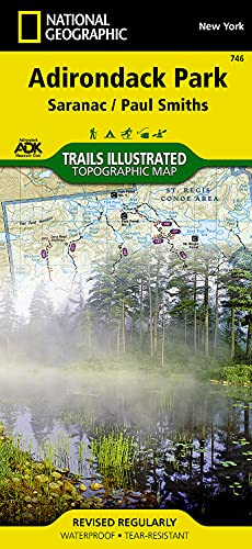
National Geographic's Trails Illustrated map of Adirondack Park Saranac/Paul Smiths is a two-sided, waterproof, topographic trail map designed to meet the needs of outdoor enthusiasts with unmatched durability and detail. This map was created in cooperation with the Adirondack Mountain Club and is loaded with valuable recreation information, from the marsh to the forest, alongside lakes and through historic neighborhoods. Trails and major roads are clearly distinguished, along with canoe access and ski areas. Campgrounds, lookout towers, rock climbing, and fishing easements are labeled and easy to find and boundaries for park lands, wilderness, primitive, forest, and protected areas are clearly marked. Discover the Adirondack's wild, rugged and beautiful terrain, with detailed elevation contours, shaded relief, vegetation, and water features.
Coverage includes McKenzie Mountain and Sentinel Range Wilderness Areas; Raquette Boreal, Whitehill, Saranac Lakes, Debar Mountain and Taylor Pond Wild Forests; Saint Regis Canoe Area; Saint Regis Falls, Lyon Mountain, and Au Sable Forks.
The Adirondack Park Saranac/Paul Smiths map is designed and printed in the United States on durable synthetic paper, making it waterproof, tear-resistant, and trail tough made to head outside and go anywhere you do. The map is two-sided, and is folded to a packable size of 4.25" x 9.25"; unfolded size is 26" x 38".
Key Features:
Waterproof and tear-resistant
Updated regularly
Designed and printed in the U.S.A.
Detailed road network, including designations for off-highway roads
Clearly marked trails for hiking, canoeing biking, and more
Detailed topography with shaded relief and clearly defined, color-coded boundaries for parks, recreation areas, wilderness areas, forest and primitive areas.
Hundreds of places-of-interest, including campgrounds, information centers, trailheads, viewpoints, boat launches, canoe carry downs, fishing access points, ski areas, rock climbing, and specialty content unique to each area
UTM and Latitude/Longitude coordinate grid, as well as selected waypoints, and a scale bar for easy and accurate navigation.
All National Geographic trail maps contain helpful information on local regulations, safety, important contact information, and park interpretive content.
Net proceeds from the sale of this map go to support the nonprofit mission of the National Geographic Society.
- Map Scale = 1:75,000
- Sheet Size = 37.75" x 25.5"
- Folded Size = 4.25" x 9.25"
