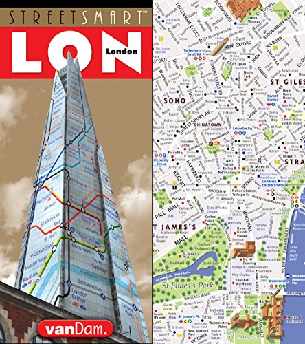
StreetSmart London Map by VanDam - City Street Map of London, England - Laminated folding pocket size city travel and Tube map with all museums. Edition Map – Folded Map, October 6, 2017
981
EUR
Book Details
Author(s)
Stephan Van Dam
Publisher
Cartodirect Gmbh
ISBN / ASIN
1934395544
ISBN-13
9781934395547
Sales Rank
#856,313
Marketplace
France 🇫🇷
Ratings & Reviews
No reviews yet — be the first!
No reviews yet.
Description
VanDam's award-winning London StreetSmart maps all top attractions including major architecture, hotels, parks, theatres, and shopping - all at an immensely legible super-scale of 1:14,000, complete with 3-D building illustrations. Clear information design allows users to read the map from three feet away and has earned VanDam maps a place in the MoMA Collection. London StreetSmart includes a stunning dimensional details of The City, Regents' Park, Marylebone, Mayfair, Bloomsbury, Soho, St. James', Holborn, Theatreland, and the West End. Edition also includes a map of Westminster and Southwark, as well as the London Metro Area and a complete Tube map. Simplicity reigns supreme in information design to make complex cities clear and understandable. Our typography creates character and reveals the true bones of the city. VanDam uses a letter grid to identify locations on maps - no confusing and cluttering K-28 or V-34s - its just the city from A-Z. Our covers map the icons of each city and turn them into collectible graphic art. Each sleek and laminated city map package opens to 32" x 9" and then easily folds down to 4" x 9" to snuggly fit into a shirt pocket or purse. Gain instant London StreetSmarts and a sexy souvenir to boot!
