


Ajo, Arizona (Western United States 1:250,000, V502P)
Book Details
Description
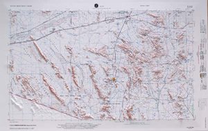
NI 12-10 is a 3-dimensional map of a mountainous region of southern Arizona. Each USGS topographic map covers 2° longitude and 1° latitude. That is about 100 miles east to west and 70 miles north to south, depending on the latitude of the map. The Ajo, Arizona map stretches from 114° West to 112° West and 32° North to 33° North.
Hubbard Scientific's USGS maps use raised relief and are a truly exceptional visual and tactile reference. They are appropriate for real estate offices, travel agencies, outdoor enthusiasts, and classroom use. You will be proud to display one of our raised relief maps in any setting.
Contour Interval: 200'
Supplementary Contour Interval: 100'
Projection: Transverse Mercator
Horizontal Scale: 1:250k
Vertical Scale: 1:125k
Vertical Exaggeration: 2:1
Size: 31" x 21"
