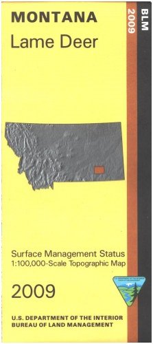
Map: Lame Deer - Surface Management
Price not available for India
You can still browse on Amazon. Try another country above.
Book Details
Description
Applies to: Montana. From Lame Deer in the Northern Cheyenne Indian Reservation travel east into a section of the Custer National Forest. Hiking and horseback riding in Cook Mountain Hiking and Riding Area in the forest, or camping at Red Shale Campground east of Ashland. Explore the forest roads, watch for wildlife, and enjoy scenic views. Official Bureau of Land Management metric topographic map @1:100,000 scale (roughly 3/4"`1 mile), color-coded to show surface management, i.e. agency vs. private or tribal ownership. Map shows color coded public and private ownership, roads, water features, recreation sites, points of interest, and the township and range lines. Use this map for hunting Deer and Elk in Units 702 and 704. 2009
