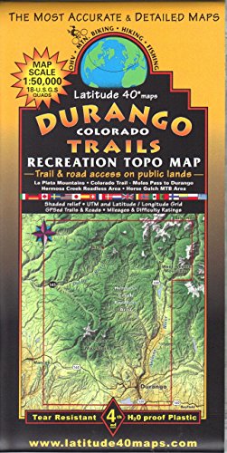
Durango Colorado Trails Recreation Topo Map
Book Details
Publisher
Latitude 40° Maps
ISBN / ASIN
B00LLYT0XC
ISBN-13
978B00LLYT0X2
Sales Rank
#4,359,994
Marketplace
United States 🇺🇸
Ratings & Reviews
No reviews yet — be the first!
No reviews yet.
Description
Lat40 Maps offers the most visually sophisticated rec maps available anywhere. Focussing on the splendor of the mountains, Lat40's maps employ digital cartography, shaded relief, and on-the-ground ground-truthing to reveal the glory of landscape and intricacy of route-finding. Whether you're a wilderness hiker, mtn bike adventurer, equestrian explorer, or fully-outfitted jeeper, you'll find these maps the perfect, user-friendly guide to your journeys. Covering the full breadth of the most important destinations, Lat40 maps include topographic contour lines, recommended routes, public access trail and road info, and explanatory notes. Lat40 prints on waterproof, tear-resistant plastic stock. These artistic docs feature double-sided maps.
For each and every map, these seasoned cartographers devote countless hours consulting w/local governing agencies and public interest groups to ensure accuracy. They travel the routes w/GPS receivers, translating the truth of the ground into the symbols of mapping. Durango Trails Map Coverage: Two-sided, self-cover, waterproof folded map. Size: 8" × 4" folded 39.3" × 25.2" unfolded
