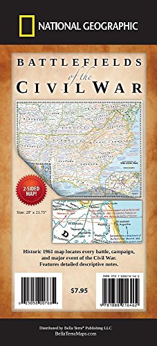
Battlefields of the Civil War Map / National Geographic Society
| List Price: | |
Our Price: $7.95 | |
|
For Bulk orders
| |
|
Used Book Price: $9.66 | |
| Battlefields of the Civil War Map / National Geographic Society | |
| Publisher: Bella Terra Publishing | |
| Availability:Usually ships in 24 hours | |
| Sales Rank: 85064 | |
|
Similar Books
Locates every battle, campaign and major event of the war. Features detailed descriptive notes. On the hundredth anniversary of the shots at Fort Sumter, National Geographic Magazine's April 1961 issue featured in-depth articles on the U.S. Civil War. The issue included a supplement map that located and described every battle, campaign and major event of the war. Now this historic map is available once again. Side one of the map covers the main region of the War from New Jersey to Louisiana. The map portrays the country as it was charted in 1863. It is based on a map on which General Grant marked his proposed lines of operation. An inset charts the major offensive of each army. Side two features more detailed maps, including "Cockpit of the Civil War" covering the area from southern Pennsylvania to southern Virginia, an inset of Gettysburg, an inset titled "Grant at Richmond", a map of War in the Southwest from Texas to California, an inset of the Vicksburg Campaign, maps of Nashville to Atlanta and Memphis to Huntsville, and an inset of battles for Atlanta. Every battle is located with a crossed-swords symbol. All key battles and events are described with National Geographic's renowned map notes. Printed two sides, 28" x 22", folded to 4" x 9".
Now you can buy Books online in USA,UK, India and more than 100 countries.
*Terms and Conditions apply
Disclaimer: All product data on this page belongs to .
.
No guarantees are made as to accuracy of prices and information.
Now you can buy Books online in USA,UK, India and more than 100 countries.
*Terms and Conditions apply
Disclaimer: All product data on this page belongs to
 .
.No guarantees are made as to accuracy of prices and information.


