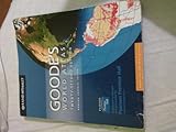
Easy To Read: Tennessee State Map (Rand McNally Easy to Read!)
Book Details
Author(s)
Rand McNally
Publisher
Rand McNally
ISBN / ASIN
052888204X
ISBN-13
9780528882043
Availability
In Stock.
Sales Rank
#159,634
Category
Travel
Marketplace
United States 🇺🇸
Description
Rand McNally's Easy To Read State Folded Map is a must-have for anyone traveling in and around Tennessee, offering unbeatable accuracy and reliability at a great price. Our trusted cartography shows all Interstate, U.S., state, and county highways, along with clearly indicated parks, points of interest, airports, county boundaries, and streets.
The easy-to-use legend and detailed index make for quick and easy location of destinations. You'll see why Rand McNally folded maps have been the trusted standard for years.
Regularly updated, full-color maps
63% larger map with a bigger type size than the Rand McNally Folded Map
Clearly labeled Interstate, U.S., state, and county highways
Indications of parks, points of interest, airports, county boundaries, and more
Mileage and driving times map
Detailed index
Convenient folded size
Coverage Area
Detailed maps of: Chattanooga, Clarksville, Cumberland Gap National Historical Park, Gatlinburg/Pigeon Forge, Great Smoky Mountains National Park, Jackson, Knoxville, Memphis & Vicinity, Nashville & Vicinity, Tri-Cities: Johnson City/Kingsport/ Bristol
Product Details
Dimensions (unfolded): 28" x 40".
Similar Products